
|
|
| Home | / | Los Angeles County | / | see more sites in | Signal Hill | OR | see more | Historical Sites and Areas | OR | see more | Scenic Locations |
Hilltop Park

|
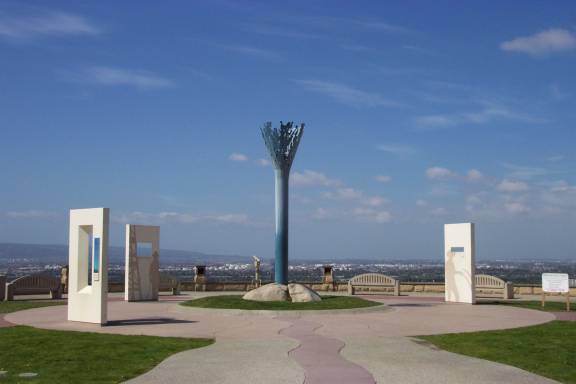
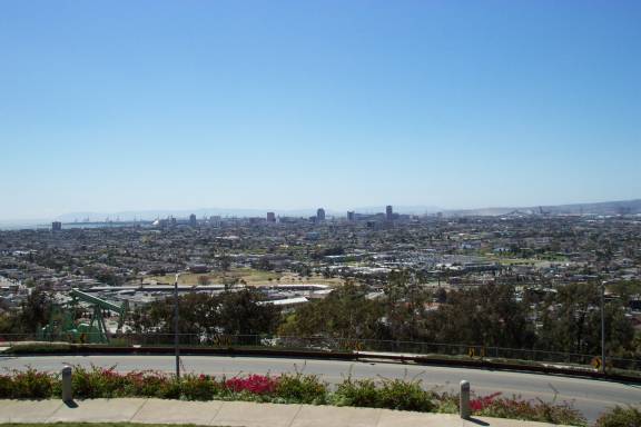
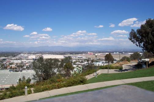
| Hilltop Park in Signal Hill offers a panoramic view of the Los Angeles basin. On a clear day, views extend from Santa Catalina Island, Palos Verdes, and along the Santa Monica and San Gabriel mountains. |
| A visit to the park not only provides a great view, but also an insight into the history of Signal Hill and the surrounding area. |

|

|
||
|
Going up the walkway leading to the center of the park, you encounter a poem etched into the sidewalk, which causes you to slow down to read the words, giving pause for reflection. The poem contains references to what has transpired on the hill over the course of many centuries. (The complete text is in the yellow box to the right) |
|||
|
|
||
|
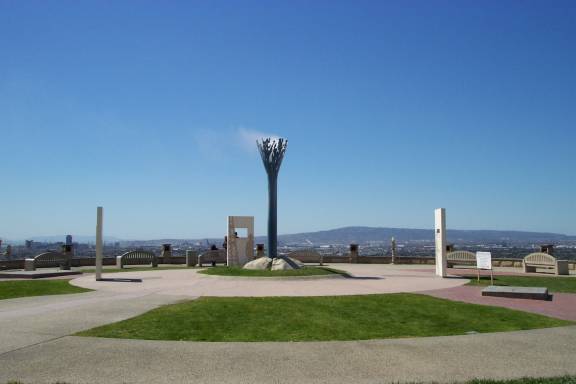
In the center of the park stands the "signal" which is symbolic of smoke-signal fires, a water tower, and oil gushers of the past. Every hour the signal emits a cloud of steam. |
|||
|
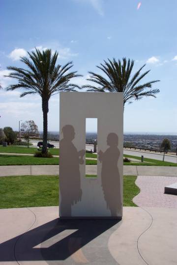
The park has 3 cut-out frames that provide a view of the city below, as well as a view of the past, by way of silhouettes depicting historic occupants of the hill. |
|||

|

|
|
|
|
LEFT - View of Long Beach harbor looking Southwest with Catalina Island in distance. "Shadow" of an oil worker from the 1920's. CENTER - View of the valley looking North - towards Los Angeles. "Shadow" of a farmer from the 1890's. RIGHT - View of the Pacific coastline looking to the Southeast - towards Huntington Beach. "Shadows" of local Native Americans from the 1990's. |
|||
|
| There are also 3 plaques that tell about history of Signal Hill. |

|
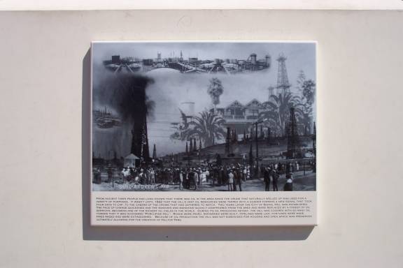
The picture to the left has the following inscription at the bottom:
The image above is an artist's conception of how this site might have looked during the thousands of years when the sole caretakers of this land were Native Americans. The long smoke signal alludes to the very long history of the use of this site which inspired the naming of the City of Signal Hill. Even though no one knows how long signal fires were made here, early Spanish immigrants called this place "Loma Sental" (Signal Hill) and documented the use of this site in the 1500's by the Puvuvitam Indians to signal their relations living some twenty six miles away on "Pimu" (Santa Catalina Island). These were among the fires that the Spanish explorer, Juan Rodriguez Cabrillo, saw when he sailed into what he called the "Bay of Smokes" (L.A. Harbor). When the Spanish Padres continued this tradition of making signal fires upon this hill, it marked the beginning of profound changes to the land and the people of California. Like the image above, the signal in the center of this park continues in this tradition and marks the current use of this land as a public space. |
|
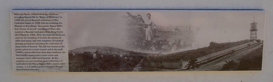
Although Spain claimed all of the Americas including Signal Hill by "Right of Discovery" in 1492, the actual Spanish settlement of Alta California began in 1769 with the building of a Mission in San Diego. As a result, Signal Hill's first "owner of record" was Manuel Nieto who received a Spanish land grant from King Carlos III of Spain in 1784. Over the years the land was used for the breeding of horses, the raising of cattle and sheep, and with irrigation, all kinds of farming prospered, including the cultivation of large fields of flowers. The hill was viewed as the perfect place for a water source and in the early 1900's with profits from their dairy business, the Deni family constructed a water tower and mansion which once stood nearby. At this moment, you are standing upon a thin layer of earth above the City of Signal Hill's unseen water source - a 1.2 million gallon reservoir of water buried below this park. |
|
From ancient times people had long known that there was oil in the area since the crude that naturally welled up was used for a variety of purposes. It wasn't until 1922 that the hill's vast oil resources were tapped with a gusher forming a new signal that took four days to cap, to the cheers of the crowd that had gathered to watch. Two years later the city of Signal Hill was established. The pace of change quickened and the ranches and mansions quickly disappeared from the area and were replaced by a forest of oil derricks, becoming one of the richest oil fields in the world. During its oil-producing heyday, the hill was covered with so many oil towers that it was nicknamed "Porcupine Hill". Roads were paved, refineries were built, pipelines were laid, fortunes were made, fires raged and were extinguished. Because of oil production the hill was not subdivided for housing and open space was preserved ultimately allowing for the creation of Hilltop Park. |
| Our visit would not be complete without taking a look at the view of the city below. |
|

|

|
|
| From left to right: |
| A view of downtown Long Beach with Catalina Island in the background. |
| The South Bay area with Palos Verdes Peninsula in the background. |
| Looking toward downtown Los Angeles, which can just barely be seen in the center of the picture. |
| A view of Long Beach airport with the San Gabriel mountians in the background. |
| Hilltop Park is located at the corner of Skyline Dr. and Dawson Ave. in the city of Signal Hill. See map. |
| Items of Interest... |
| Related Links |
| Los Angeles Oil Boom Through Maps |
| Discovering Los Angeles Oilfields |
| Unocal Corporation History |
| Home | / | Los Angeles County | / | see more sites in | Signal Hill | OR | see more | Historical Sites and Areas | OR | see more | Scenic Locations |
Copyright © 2002-22 LetsGoSeeIt.com All Rights Reserved |